

Florida’s Atlantic coast offers excellent opportunities to look for coastal and wetland birds during the cooler months, but successful birding requires more than a list of famous species. Tides, weather, seasonal migration and protected-habitat rules shape what a visitor may see. This six-day itinerary follows a southbound route from St. Augustine toward Merritt Island, Vero Beach and Palm Beach County, mixing wildlife drives with accessible boardwalks and town breaks. It is designed for beginners carrying binoculars, photographers working with long lenses, families introducing children to nature and older visitors who prefer shorter walks. No particular bird is guaranteed, and the itinerary deliberately avoids advice that would disturb nesting or feeding wildlife.
Why winter is useful for Atlantic Coast birding
Cooler weather makes repeated outdoor stops more pleasant and brings migratory waterfowl and other seasonal visitors to parts of Florida. Yet “winter birds” do not all arrive on the same day, and not every marsh becomes more active in December than in March. Rainfall, cold fronts, tide levels and habitat management matter. Winter can also bring busy roads and full parking lots in coastal towns. A birding trip is most flexible when you plan habitat visits rather than guaranteed species: estuaries for shorebirds, managed wetlands for waders and open-water edges for waterfowl.
Start with binoculars and a field guide or reputable identification app; a camera is optional. Learn to observe posture, bill shape, color pattern and behavior before attempting an identification. Many herons and egrets change plumage with age, and distant birds can look misleadingly similar. A child may find “count three different feeding styles” more engaging than a competition to identify twenty species. An older visitor can enjoy a single productive observation platform without needing to walk a long trail. Patient observation is a legitimate way to experience the Atlantic coastal landscape.
Day one: St. Augustine and protected coastal habitats
Begin with an arrival and orientation around St. Augustine, choosing a legal public shoreline observation point or a visit to a coastal research reserve where visitor facilities are open. The Guana Tolomato Matanzas National Estuarine Research Reserve, often shortened to GTM, is an important resource for understanding coastal ecology in this region. Before arriving, confirm its current visitor-center schedule, trail regulations and any storm-related closures. Do not assume every tract can be reached from the same parking lot. Estuaries are made of connected habitats but can have very different roads and access points.
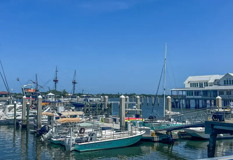
A short late-afternoon observation can reveal how tides influence shorebird feeding and why salt marshes matter to migrating animals. Stay on designated boardwalks or trails and never walk into nesting areas. Bring insect repellent even during cooler months, since mosquitoes are not strictly a summer concern. The first evening is a good time to practice identifying common shapes—egrets, gulls, cormorants or terns—without worrying about a complete checklist. Rest in St. Augustine or farther south only after checking the next day’s driving distance.
Day two: coastal wetlands and a comfortable transfer
Use the second morning for another St. Augustine-area habitat or for a nearby nature walk that is officially open. Wildlife tends to be easier to observe when you arrive early and limit noise, but a spectacular sunrise is not required. If you are photographing birds, do not pursue a moving flock from one parking lot to another. Watch what the animals do before you lift the camera. Moving slowly also helps prevent a common error: walking close enough to flush shorebirds from a feeding area simply to obtain a better image.
In the afternoon, drive south toward Titusville and the Space Coast. This is a transfer, not a second full birding day. Choose accommodation with easy morning access to Merritt Island National Wildlife Refuge, and check NASA-related area notices before setting an exact arrival time. The refuge overlaps Kennedy Space Center land, and operational restrictions can affect roads and visitor facilities. Keep food and water available because birding destinations are not always close to restaurants. Review your observations in the evening and prepare binoculars, hats and sun protection for the next morning.
Day three: Merritt Island's Black Point Wildlife Drive
Merritt Island National Wildlife Refuge is a core stop because its Black Point Wildlife Drive provides a slow vehicle-based route through managed marshes. The federal refuge’s visitor information confirms that an entry pass is required for certain areas, and access may change during launch operations. Download or collect current visitor materials and drive patiently, pulling over only at permitted stops. Watch for wading birds along water margins, raptors overlooking marshes and waterfowl in suitable season.
The route is particularly useful for travelers with limited walking endurance, although some viewing stops require different amounts of mobility. The visitor-center boardwalk is identified by the refuge as the wheelchair-accessible route among its listed trails, while other surfaces may be mowed grass or uneven ground. Ask rangers about conditions instead of assuming every tower is reached by pavement. Do not block the wildlife drive to take photographs from the middle of the road. A slow morning with frequent short pauses can be more productive than a long hike that disturbs birds.
Day four: Pelican Island near Vero Beach
Continue south to Pelican Island National Wildlife Refuge, America’s first national wildlife refuge. The official Pelican Island visitor page describes observation opportunities and an accessible Centennial Trail leading toward views of the protected island. This is a place to appreciate conservation history as well as birds. Do not assume the island itself is a visitor destination where you may land. Its value lies partly in protecting habitat from exactly that kind of disturbance.
Spend time on the boardwalk and watch how birds use the lagoon at different water levels. A spotting scope or telephoto lens makes it easier to view distant individuals without leaving the permitted route. Other refuge trails may be longer or have different surfaces; choose them only if they fit your group’s ability and the weather. Carry water because an open observation platform can feel hot even during winter. If traveling with school-age children, invite them to draw a simple map of the refuge and note why an area can be protected while still allowing visitors at designated observation points.
Day five: the Indian River Lagoon and a move to Palm Beach
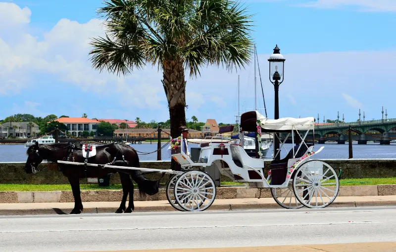
Use the fifth day as a flexible coastal exploration and transfer toward Palm Beach County. The Indian River Lagoon is a large, diverse estuary, but wildlife habitat and access conditions change along its length. Choose one publicly permitted observation site rather than stopping at every water-facing road. Shorebirds may be far away at high tide or grouped in places that are closed to pedestrians. A quiet hour observing from a legal deck is more valuable than approaching a roost on a sandbar. Respect signs protecting turtles and sensitive coastal vegetation.
Plan lunch and drive time deliberately. Highway traffic near growing coastal towns can consume much more of a day than a map suggests. If you want to add a beach stop, first check local water and weather advisories; birdwatching does not require entering the ocean. For wheelchair users, review the exact distance from parking to the chosen platform. If a grandparent or younger child is tired, use the afternoon for accommodation check-in and a short local walk. Good birding often depends on returning alert the following morning.
Day six: constructed wetlands and South Florida birdlife
Finish in Palm Beach County with a visit to a managed wetland or boardwalk where public access and current conditions are confirmed. Wakodahatchee Wetlands and Green Cay are well-known examples of accessible-style birding experiences, but individual boardwalks, parking and opening conditions can change. Verify county notices before choosing a route, and do not assume that every platform will be usable after maintenance or storm damage. These settings offer a chance to compare human-managed freshwater wetlands with the estuarine habitats farther north.
Observe from established paths and keep a respectful distance from nests. In a popular wetland, photographers sometimes gather near a single bird; do not form a crowd that blocks wheelchair users or strollers. Put the camera away occasionally and listen to calls or look for smaller birds among vegetation. A final day can be as brief as one careful walk followed by a leisurely meal. If returning to an airport, leave enough time to avoid making the final boardwalk a frantic rush.
Birding etiquette and conservation rules
Never use food, sound recordings or flash to manipulate wildlife unless the land manager expressly permits an activity; in many situations the ethical choice is simply not to do it. Do not attempt to relocate or handle chicks, eggs or injured birds. Contact appropriate wildlife authorities if there is a genuine concern. At sensitive nesting sites, follow seasonal closures even if a path appears empty. A protected island may hold important breeding habitat beyond the view of tourists. Viewing from a distance is part of successful wildlife travel, not a failure to get close.
Use tripods only where allowed and keep them clear of narrow boardwalks. Families should make space for people moving more slowly and teach children not to chase birds. Dogs are restricted in some refuges, while genuine service-animal rules are different; check the site-specific policy. If you record an unusual bird for a public checklist, think carefully before posting a precise location that could attract crowds during sensitive nesting periods. Shared observations can contribute to knowledge without turning conservation land into a competitive spectacle.
Photographs, notebooks and species identification
A simple notebook with date, site, weather, tide if relevant and rough behavior observations is more useful than a long unsorted list of guesses. Binoculars allow closer views without disturbing birds, while a field guide can help separate common egrets or shorebirds. Take a few photographs of habitat context as well as close-ups; these help reconstruct where the bird was feeding. If uncertain of a species, record that uncertainty rather than inventing a confident label. Birdwatching is a learning practice, and expert birders make corrections too.
Beginners can use a short target list based on common forms rather than rare sightings. Look for a tall white wader, a dark diving bird, a soaring raptor and a small shoreline runner. Compare feeding behavior and bill shape. Do not force identification through binoculars when the bird is too distant. A volunteer or ranger may help if available. For children, allow regular breaks and an age-appropriate challenge such as drawing a bird’s posture rather than keeping them quiet for hours.
Seasons, tides, storms and morning schedules
Winter has comfortable periods but is not free of storms, wind or cold mornings. Layer clothing and keep a rain plan. Bird concentrations can change with water depth, tidal cycles and maintenance of managed impoundments. A single quiet morning does not mean a refuge has no birds. If a cold front passes, watch for changes in bird activity but do not stand on an exposed platform during lightning. The official operating schedule is more important than an idealized sunrise photograph; gates may open after daylight begins.
In summer, birding is still possible but heat and mosquitoes can shorten outings, and sea turtle nesting may affect beach access. If visiting during hurricane season, respect emergency closures and avoid remote roads after heavy rain. A six-day itinerary should have at least one flexible afternoon in case weather removes a planned stop. Those wishing to photograph particular species should research migration patterns and permits more deeply, but a general-interest birding vacation can succeed without exact seasonal predictions.
Accommodation, driving and accessibility
A practical arrangement is one or two nights near St. Augustine, two around Titusville and the Space Coast, one near Vero Beach and one in Palm Beach County. This requires several hotel changes. If that sounds tiring, shorten the trip and concentrate on Merritt Island and Pelican Island from two bases. A rental car makes the route much easier; public transit rarely takes you directly to scattered refuge trailheads early in the morning. Check parking fees and entry requirements rather than expecting every wildlife stop to be free.
For wheelchair users, seek named accessible paths and ask about maintenance. A refuge’s “flat trails” may still be grassy or unpaved; the difference can determine whether a visit works. Families with preschoolers may choose one short boardwalk and a nearby lunch rather than a full-day photography session. Older visitors can favor wildlife drives, shaded observation areas and morning breaks. There is no single correct way to be a birder, and physical endurance is not a prerequisite for enjoying protected wetlands.
Six-day birding table
| Day | Area | Habitat | Priority check |
|---|---|---|---|
| 1 | St. Augustine | Estuary and coastal reserve | Specific GTM visitor access |
| 2 | St. Augustine to Titusville | Optional shorebirds and transfer | Travel time |
| 3 | Merritt Island | Managed marshes and wildlife drive | Refuge pass and launch closures |
| 4 | Pelican Island | Lagoon and protected rookery views | Boardwalk and trail conditions |
| 5 | Indian River Lagoon | Public coastal observation sites | Legal access and tide |
| 6 | Palm Beach County | Managed freshwater wetlands | Current boardwalk notices |
Frequently asked questions
Is December better than February for birdwatching?
Both can be rewarding, with different weather and bird activity. Exact species depend on migration, tide and habitat rather than a guaranteed calendar date.
Can we visit Pelican Island itself?
The refuge protects the island, which is viewed from designated public trails and observation points. Do not assume landing or entering nesting areas is permitted.
Can a beginner follow this itinerary without a guide?
Yes, with binoculars, official site maps and modest expectations. A ranger program can enrich the experience when offered, but independent observation at designated sites is worthwhile.
Is this itinerary suitable for wheelchair users?
Some highlighted refuges have identified accessible routes or driving opportunities. Check the specific surfaces and closures; do not assume all trails at each refuge are accessible.
Do I need a big camera to enjoy the birds?
No. Binoculars and a notebook are enough. Birdwatching values observation and conservation, and an ethical distant view matters more than a close image.
Official birding references
Review Merritt Island refuge visitor information, the Pelican Island refuge guide, and the US Fish and Wildlife Service wildlife-watching guidance. Prepared October 2026; public access, tides and weather conditions must be reconfirmed.