Category: National Wildlife Refuges

  • St. Marks National Wildlife Refuge Guide: Fees, Lighthouse Road, Birding and Tallahassee Tips

    St. Marks National Wildlife Refuge Guide: Fees, Lighthouse Road, Birding and Tallahassee Tips

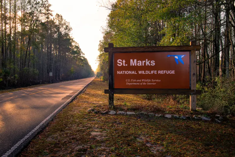
    St. Marks National Wildlife Refuge is the best choice near Tallahassee for travelers who want a full Big Bend landscape: freshwater impoundments, pine forest, salt marsh, coastal wildlife and the historic St. Marks Lighthouse corridor. It is especially strong for birders and photographers, but the refuge also works for families who are comfortable with a scenic drive and short walks rather than a conventional attraction.

    Explore this guide

    The refuge is open year-round during daylight hours, with the Lighthouse Road gate currently opening at 6:00 a.m. The current entrance fee is $5 per vehicle or $1 per pedestrian/bicycle. The visitor center is currently open weekdays 8:00 a.m.–4:00 p.m. and weekends 10:00 a.m.–5:00 p.m., except federal holidays.

    Quick planning summary

    • Outdoor access: daylight hours; Lighthouse Road gate currently opens at 6:00 a.m.
    • Current fee: $5 vehicle, $1 pedestrian/bicycle
    • Visitor center: Mon–Fri 8:00–4:00; weekends 10:00–5:00
    • Time needed: 3–5 hours for scenic drive, ponds, trails and coast
    • Best for: birding, wildlife, photography, scenic drives and quiet nature days
    • Important rule: no swimming; drones prohibited

    Important current-status note

    October 2026 information snapshot: this article is scheduled for 2028. Hours, fees, construction zones, exhibit access, boat-tour schedules, trail conditions and wildlife closures can change before publication. Use the practical details below as a verified planning baseline, then check the linked official source shortly before the trip.

    The Lighthouse Road experience

    For first-time visitors, the simplest plan is to drive Lighthouse Road slowly and stop at ponds, short trails and coastal viewpoints. Wildlife activity changes by season and water level. Late fall through early spring is often the most comfortable time, and migration can make birding especially rewarding.

    Wildlife expectations

    Expect uncertainty. An alligator may be visible near one pond one day and absent the next. Winter waterfowl and migratory birds vary with weather. Bring binoculars and spend longer at fewer stops instead of rushing every pull-off.

    Lighthouse access

    The lighthouse is an iconic destination, but interior access is not guaranteed. Current refuge information says lighthouse openings are subject to schedule changes. Treat the exterior setting and coastal landscape as the core experience, then consider a lighthouse opening a bonus if it aligns with your date.

    Food, restrooms and remoteness

    There is no food service inside the refuge. Bring water, snacks and a packed lunch if staying several hours. Restrooms are available at the visitor center and Tower Pond Trail, but the refuge notes that some restroom facilities do not fully meet current accessibility standards.

    Official information

    Check U.S. Fish & Wildlife Service for current closures, visitor-center hours, fees and refuge rules.

    Planning the visit for different ages

    For mixed-age groups, the best strategy is to combine one high-interest stop with one low-effort stop. Babies and toddlers usually need shade, reliable restrooms and room to reset. School-age children often respond well to animals, reconstructed history and interactive outdoor spaces. Teenagers may prefer zip lines, scenic drives, photography and less structured time. Older travelers often appreciate museums, gardens and boat tours where the experience does not depend on long walks. Accessibility varies widely, especially at archaeological and refuge sites, so check the official accessibility information when mobility is a major factor.

    Best season, heat and rain

    Late October through April is usually the easiest season for long walks, gardens and wildlife drives. Spring can be especially pleasant, although pollen is noticeable and popular gardens attract more visitors. Summer is hot, humid and storm-prone. Outdoor plans are usually better in the morning, with museums or lunch reserved for the hottest part of the day. The Big Bend coast can also be affected by tropical systems, prescribed burns, flooding and temporary wildlife closures. Check radar and official alerts before driving to a remote site.

    Accessibility and low-effort alternatives

    Tallahassee has several good choices for travelers who want meaningful sightseeing without long walks. The Historic Capitol, Goodwood grounds, short museum visits and a river boat at Wakulla Springs can all work well when heat, mobility or stamina limits a longer outdoor day. At nature preserves and archaeological parks, surface conditions may include roots, grass, sand or uneven ground. Never assume that a short trail is automatically stroller- or wheelchair-friendly.

    Tallahassee Florida Historic Brick Government Building

    What to bring

    • Refillable water bottle
    • Sun protection and sunglasses
    • Light rain layer from late spring through early fall
    • Insect repellent for refuges, wetlands and evening walks
    • Comfortable shoes for brick, grass, roots and museum floors
    • Binoculars for wildlife sites
    • Downloaded map for remote Big Bend locations
    • A light layer for heavily air-conditioned museums and boat rides

    How to combine it with nearby places

    St. Marks is best treated as a dedicated nature half-day from Tallahassee. For a gentler wildlife day, choose Wakulla Springs instead of trying to do both quickly.

    Common planning mistakes

    • trying to combine downtown Tallahassee and the Gulf coast in a tightly timed half-day
    • assuming every museum is open seven days a week
    • arriving at a state park or refuge without checking current alerts
    • scheduling only outdoor stops during a summer afternoon
    • treating wildlife sightings as guaranteed
    • forgetting that government-area construction can change entrances and parking

    How this stop fits a longer Florida road trip

    Tallahassee works well as a two-night break between North Central Florida and the western Panhandle. Travelers coming from Cedar Key or Ocala should avoid treating the drive as dead time: the landscape changes noticeably as you move into pine forest, rolling terrain and the Big Bend. If you are continuing west, use Tallahassee for history and food, then dedicate a separate half-day to Wakulla Springs or St. Marks rather than squeezing them into departure morning.

    Final planning advice

    Build the day around one anchor experience and leave at least one hour unassigned. Tallahassee rewards curiosity more than speed: an unexpected legislative exhibit, wildlife sighting, garden in bloom or slower lunch often becomes more memorable than the attraction you originally thought would be the highlight.

    A more realistic way to plan the day

    Tallahassee and the surrounding Big Bend are easier to enjoy when you plan by geography rather than by attraction count. Downtown history, north-side gardens, west-side museums and the coastal wildlife corridor south of the city are not all next door to one another. Traffic is usually manageable compared with South Florida, but parking, state-government schedules, heat and afternoon storms can still turn an overpacked day into a rushed one.

    Tallahassee Florida Capitol Square and Monument

    Count transitions as part of the itinerary. Parking, security checks, walking back to the car, changing clothes after water activities and waiting for a tour all consume time. A day with two strong stops and an unhurried meal is usually more satisfying than four attractions connected by constant driving. This is especially true in summer, when heat and thunderstorms make the middle of the day less predictable.

    Budget and value

    Tallahassee can be a relatively affordable Florida destination because several major sites are free or low-cost. Spend where it improves the experience: a guided boat at Wakulla Springs, a timed historic-house tour or a family attraction may be worth more than adding several minor paid stops. Free parks and museums are most valuable when they match your interests, not simply because they cost nothing.

    Photography and wildlife etiquette

    Use a longer lens or binoculars instead of approaching wildlife. At historic and archaeological sites, stay on public routes and do not move objects for photographs. Tripods, commercial shoots and drones may be restricted, especially on government property, in museums and on federal wildlife refuges. When in doubt, ask before setting up equipment.

    Food, water and restroom planning

    Downtown Tallahassee has many food options, but remote parks and refuges do not. Carry water in the car and never assume that a visitor center, cafe or vending area will be open simply because the outdoor site is accessible. Families with young children should identify the last reliable restroom before driving toward a refuge or spring.

    If the weather changes

    Keep one indoor backup in mind. The Historic Capitol, a house museum or another city attraction can replace a stormy outdoor block. After lightning passes, do not immediately resume swimming or exposed-trail activities unless staff or official alerts indicate conditions are safe. A flexible itinerary is a strength, not a failure to plan.

    Parking, arrival time and daily rhythm

    For city attractions, arriving close to opening usually solves more problems than hunting for a perfect parking space later. Government offices, university schedules and weekday commuters can make downtown feel busier between late morning and mid-afternoon. At parks and refuges, early arrival improves wildlife activity and lowers heat exposure. If your group includes a stroller, wheelchair, large cooler or several children, choose parking convenience over saving a few dollars or walking several extra blocks.

    Leave 15 to 30 minutes between major stops even when mapping apps show a short drive. That margin covers walking back to the car, finding the next entrance, restroom breaks and unexpected construction. It also keeps one delayed stop from pushing every meal and reservation later.

    Planning for multigenerational groups

    A multigenerational Tallahassee day works best when everyone shares the first anchor activity and the group has permission to split briefly afterward. Grandparents may prefer a shaded museum or garden bench while teenagers walk a longer trail or explore photography. Parents with toddlers may need an earlier lunch. Rejoining for one meal or one easy final stop keeps the trip social without requiring every traveler to move at the same speed.

    What is worth booking in advance

    Book anything that has a fixed departure, limited tour size or special access. River boats, historic-house tours, adventure courses and special programs are more vulnerable to selling out than open-air parks. Free museums and city parks usually need less advance planning, but event weekends can still change parking and opening patterns. Recheck reservations a day or two before travel if storms or construction are possible.

    When to skip this stop

    Skipping an attraction can be the right decision when the weather, construction status or interests of your group make the experience poor value. A garden outside bloom season, a wildlife refuge during intense midday heat or a history site with a tired toddler may be better saved for another trip. Wonderful Florida itineraries should help travelers choose, not create pressure to complete a checklist.

  • Lower Suwannee National Wildlife Refuge Guide: Nature Drive, Trails, Wildlife and Cedar Key Tips

    Lower Suwannee National Wildlife Refuge Guide: Nature Drive, Trails, Wildlife and Cedar Key Tips

    Lower Suwannee National Wildlife Refuge is the large, wild landscape behind many of the smaller Nature Coast experiences around Cedar Key. The refuge protects roughly 53,000 acres around the lower Suwannee River and estuary, with wildlife drives, lime-rock roads, trails, fishing access, paddling and birding. It is not a single attraction with a gate and one visitor route; it is a network that rewards advance planning.

    Explore this guide

    For a first visit from Cedar Key, allow half a day and focus on the Levy County side or Shell Mound rather than trying to “do the refuge.” The refuge is open from sunrise to sunset, and no camping or overnight parking is allowed inside refuge boundaries.

    Quick planning summary

    • Hours: outdoor areas open sunrise to sunset
    • Best first-timer route: Levy County Nature Drive plus one formal trail, or Shell Mound as a separate focused visit
    • Roads: many are maintained lime rock; drive slowly and expect dust, potholes or seasonal conditions
    • Activities: wildlife viewing, hiking, biking, fishing, photography, paddling and scenic driving
    • How much time: 3–5 hours for a focused visit; a full day for serious birding or multiple trail areas
    • Facilities: limited compared with state parks; bring water, food and a downloaded map

    Important current-status note

    October 2026 information snapshot: this article is scheduled for 2028, so hours, fees, storm recovery, trail conditions, ferry or boat access, museum schedules and wildlife closures should be checked again shortly before travel. Cedar Key and the lower Suwannee coast are low-lying, tide-driven places where weather and restoration work can change practical access faster than in a large city destination.

    Understanding the refuge layout

    The U.S. Fish & Wildlife Service divides visitor access into three broad areas: Shell Mound about nine miles north of Cedar Key, the Levy County side with a nine-mile Nature Drive and formal trails, and the Dixie County side north of the Suwannee River. For a Cedar Key visitor, the Levy County side and Shell Mound are the most efficient starting points.

    Nature Drive

    The Nature Drive is useful for travelers who want wildlife and habitat without a long hike. It also works for senior travelers, photographers carrying heavy equipment and families in hot weather because you can alternate short walks with time in the vehicle. The trade-off is that wildlife is never guaranteed, and road conditions can change after heavy rain.

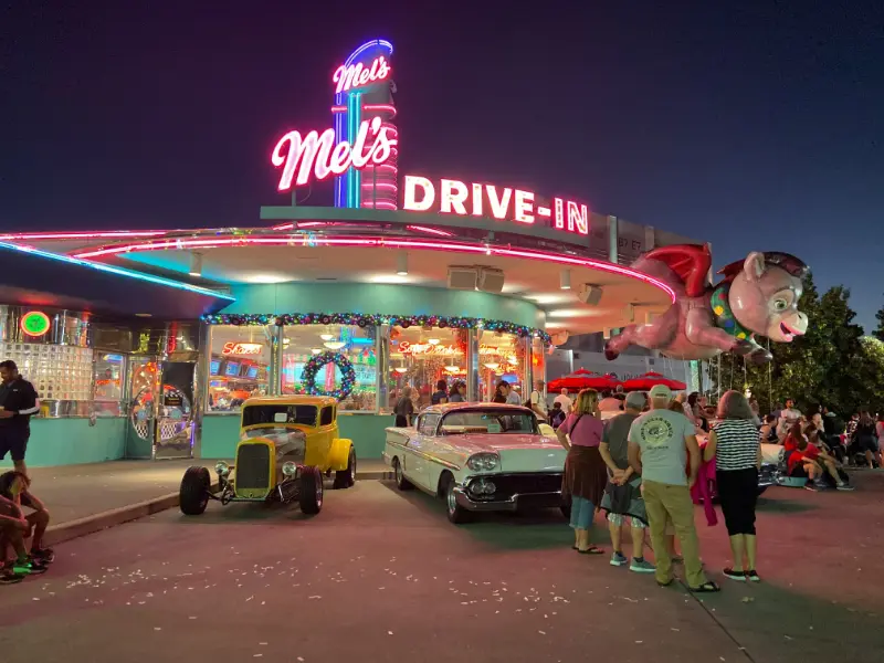
    Orlando Drive In Sign at Sunset

    Trails and biking

    The refuge has formal trails plus many grass roads open to walking and biking. FWS notes that there are extensive road and trail networks across the refuge. A bicycle can be a great way to explore in cooler months, but sandy or rough surfaces make this very different from a paved rail trail. Bring repair basics and do not assume drinking water is available.

    Wildlife viewing

    The refuge protects an estuarine system used by manatees, Gulf sturgeon, shorebirds, wading birds and waterfowl. The best strategy is to watch habitat rather than chase a species checklist. Slow down at ponds, marsh edges and openings, use binoculars, and stay long enough for the landscape to become active.

    Hunting seasons and shared use

    The refuge hosts managed hunts. That does not mean general recreation stops, but it does mean visitors should check current hunt dates and regulations before hiking remote roads. Wearing visible clothing and choosing more popular visitor routes can make a mixed-use day more comfortable.

    Official information

    Use the U.S. Fish & Wildlife Service Lower Suwannee visitor page and current refuge map before entering remote areas.

    Planning the visit for different ages

    This part of Florida can work very well for mixed-age groups, but the best activity is not always the most adventurous one. Babies and toddlers usually need shade, predictable restrooms and short outdoor blocks; school-age children often enjoy wildlife spotting and simple museum stories; teenagers tend to appreciate paddling, photography and less structured time; older travelers often prefer scenic drives, boardwalks, museums and short trails. Build the day around the least flexible traveler and let everyone else add optional activities around that core plan.

    Weather, tides and the best season

    Late fall through spring usually brings the most comfortable temperatures for walking, birding and exploring historic sites. Summer is hot, humid and storm-prone, with mosquitoes and no-see-ums often more noticeable near marshes. Tropical weather can affect Cedar Key and the Nature Coast from summer into fall. On any coastal day, check radar, tide, wind and local alerts before committing to a long paddle or remote trail, and carry more drinking water than you think you will need.

    Tides matter here in a way they do not on many inland Florida trips. A shoreline, creek or launch that looks easy at high water can become muddy, shallow or difficult at low tide. If your day includes paddling, fishing or island access, look at a local tide table and ask the outfitter or refuge staff how the tide changes the route. For land-only sightseeing, tides are less critical but still shape wildlife viewing and the look of the marsh.

    Accessibility and low-effort alternatives

    Accessibility varies sharply from paved museum grounds to natural-surface refuge roads and sandy trails. Before traveling with a wheelchair, walker or stroller, check the official accessibility notes for the specific site rather than assuming a short trail will be smooth. A useful low-effort backup in this region is to combine a museum, a scenic waterfront drive and a meal instead of forcing a trail when heat, mobility or weather makes it a poor choice.

    Orlando Retro Diner Drive In at Night

    What to bring

    • Refillable water bottles and a small cooler for remote sites
    • Sun protection, hat and sunglasses even in winter
    • Insect repellent for marsh and forest stops
    • Closed shoes for shell, sand and uneven trail surfaces
    • A lightweight rain layer in warm months
    • Binoculars for birds and dolphins
    • A paper or downloaded map when cell coverage may be weak
    • Dry bag or waterproof pouch if the day includes boats or kayaks

    How to combine it with nearby places

    Pair a half-day refuge visit with Cedar Key rather than adding another distant spring on the same day. If the goal is archaeology and coastal views, choose Shell Mound as the focused refuge stop.

    Common planning mistakes

    • trying to schedule too many remote sites in one day
    • assuming every natural area has food, shade and full-service restrooms
    • ignoring tide, heat or storm conditions because the route looks short
    • arriving late at a site with limited museum days or early closing
    • treating wildlife sightings as guaranteed
    • forgetting that storm recovery can change access for months or years

    Final planning advice

    The best trips on this stretch of the Nature Coast are intentionally unhurried. Choose one anchor activity, add one nearby secondary stop, and leave room for weather, wildlife, a longer lunch or an unexpectedly good sunset. That rhythm is more realistic than building the day like an Orlando attraction schedule, and it fits the character of Cedar Key and the lower Suwannee coast much better.

    Decision guide: is this stop right for your trip?

    Choose this stop when it matches the purpose of the day rather than because it appears on a “must-see” list. Cedar Key and Levy County reward selective planning. History-focused travelers should prioritize museums and archaeological sites; wildlife travelers should spend more time in refuges; families often do best with one educational stop plus outdoor time; active travelers can build the day around paddling or longer trails. If the attraction duplicates something your group has already done elsewhere in Florida, use the time for a slower meal, sunset or a different habitat instead.

    Budget also includes time, fuel and comfort. A free refuge can cost more in planning effort than a small paid museum because you need water, navigation and a longer drive. Conversely, a low admission fee does not make a museum worthwhile if you arrive fifteen minutes before closing. Compare the total experience—not just ticket price—when deciding what deserves a place in a short itinerary.

    A practical pre-trip checklist

    • Confirm the official opening status on the morning of the visit.
    • Check radar, heat index, wind and tide when the day includes exposed coast or water.
    • Download directions before leaving the town center.
    • Carry water and snacks when heading into refuge or state-reserve areas.
    • Tell someone your route if paddling or hiking away from developed areas.
    • Keep one flexible alternative that does not depend on the same weather condition.

    This simple checklist is especially useful for multigenerational trips. It turns the day from a sequence of optimistic assumptions into a plan that can absorb closures, heat, fatigue or weather without feeling ruined.

    Practical comfort and pacing

    A useful way to judge the pace is to count transitions rather than attractions. Every time the group moves from car to trail, trail to museum, museum to lunch or dry clothes to swim gear, the day loses time and energy. Families with small children and older travelers feel those transitions most. Two well-chosen stops with a real lunch break usually produce a better day than four stops connected by hurried parking and short walks.

    Plan shade and restroom breaks before they become urgent. In small Nature Coast communities, a remote trailhead may have basic facilities while the next reliable restroom is several miles away. Keep drinking water in the vehicle, do not leave electronics or food exposed to heat, and change into dry clothing before a long drive after swimming. These details sound minor, but they are what separate a relaxed day from one that feels harder than the destination deserves.

    How this stop fits a longer Florida road trip

    On a longer itinerary, Cedar Key and Levy County work best as a deliberate change of pace between larger Florida destinations. Do not treat the area as a quick detour squeezed between two long drives. If you are coming from Gainesville or Ocala, arrive early enough to enjoy the coast before sunset. If you are continuing toward Crystal River, leave the following morning rather than driving south after a full outdoor day. That gives the Nature Coast enough time to feel distinct instead of becoming scenery through the windshield.

    For travelers covering Florida over one or two weeks, alternate active and easy days. A paddling or hiking day here can follow a museum-heavy city day, while a quiet Cedar Key museum-and-waterfront day can serve as recovery after springs, long drives or theme parks. The destination is most valuable when you use its slower rhythm intentionally.

  • St. Marks National Wildlife Refuge: Lighthouse Road, Birdwatching and Gulf Coast Wildlife

    St. Marks National Wildlife Refuge: Lighthouse Road, Birdwatching and Gulf Coast Wildlife

    South of Tallahassee, St. Marks National Wildlife Refuge protects a meeting point of freshwater wetlands, coastal marshes, forests and the Gulf. It is a very different kind of Florida attraction from a manicured garden or an urban museum. Travelers come for the long views, birds, quiet roads, the historic St. Marks Lighthouse setting and the chance to see how a protected landscape changes with the seasons. A rewarding visit depends on respecting that this is a wildlife refuge first: some trails close to protect nesting animals or during prescribed burns, and sightings are never guaranteed.

    Understanding the refuge’s landscape

    The refuge covers diverse habitats where saltwater and freshwater influence what grows and which animals can live. Around Lighthouse Road, marshes and pools can attract wading birds and other wildlife, while nearby forested sections offer different experiences. Seasonal changes in water level make the landscape feel dramatically different from one visit to the next. A pool alive with birds in winter may appear quieter at another time of year, without implying that the habitat has lost its ecological value.

    The U.S. Fish and Wildlife Service identifies a remarkable range of bird species associated with St. Marks, and the area appeals particularly to patient birdwatchers. You do not need binoculars worth hundreds of dollars to enjoy it, but a simple pair can help you view distant animals without disturbing them. Instead of racing from viewing point to viewing point, spend several minutes standing still. Watching behavior — a bird feeding, resting or hunting — can be more interesting than ticking another species off a list.

    Directions, visitor center and entrance rules

    The official refuge page gives its visitor-center address as 1255 Lighthouse Road, St. Marks, FL 32355, south of Tallahassee. The visitor center is roughly twenty-five miles from the city according to the agency’s route description, though actual driving time depends on traffic, stops and weather. Lighthouse Road leads through the refuge toward the coast. The refuge requires an entrance fee, and the outdoor areas are generally open in daylight hours; the official page notes that the Lighthouse Road gate opens at 6 a.m.

    The visitor center has its own schedule, so do not assume it opens whenever the road is accessible. Before leaving your hotel, save an offline map and read current notices about roadwork, fires or protected-wildlife closures. Keep the entry receipt or pass if relevant and obey speed limits even when the route looks empty. Animals may cross unexpectedly. A car is the most straightforward way to explore many of the stops, and visitors relying on a rideshare should think carefully about return transport in a relatively remote coastal area.

    The Lighthouse Road experience

    Lighthouse Road is the natural starting point for a first visit. It offers a sequence of changing marsh views with designated places to stop. As you travel south, look for differences between freshwater ponds, open marsh and coastal habitats. Pull into legal parking or observation areas rather than stopping unpredictably in a lane when you spot a bird. Wildlife watchers should share viewpoints politely and leave access clear for refuge staff and emergency vehicles.

    Florida Lighthouse Silhouette at Sunset

    The route is especially appealing to travelers who want an outdoor experience without committing to a demanding hike. Still, driving does not remove every challenge: a short walk from a parking area can involve uneven gravel, insects or strong sun. Bring water and use a restroom when one is available. If someone in your group has mobility limitations, ask refuge staff which stops offer the safest accessible surfaces rather than assuming every trail or levee is suitable for wheelchairs.

    St. Marks Lighthouse and its history

    The white lighthouse at the southern end of the road provides an unmistakable focal point and connects the refuge to the maritime history of the Gulf Coast. Yet seeing the building from outside is not the same as touring its interior. The U.S. Fish and Wildlife Service warns that lighthouse access and tours are subject to schedule changes and should be confirmed through events information or the visitor center. Do not promise children that they will climb the tower based solely on an exterior photograph.

    The lighthouse setting rewards slow observation even when an interior tour is unavailable. Stand in a designated area and consider why a navigational light was important along a coast with marshes, shoals and changing weather. The surrounding scenery is just as significant: look outward at the meeting of land and water, and think about how navigation, fishing, conservation and habitat restoration intersect. On windy or stormy days the exposed coast can feel very different from sheltered inland trails.

    Birdwatching through the seasons

    Late fall through early spring often offers more comfortable temperatures for birding and walking, and migrations can influence what visitors see. Summer brings heat, humidity, thunderstorms and biting insects; wildlife may be active, but human comfort becomes a bigger constraint. Tide, rainfall and water management also influence bird concentrations. A day with fewer visible birds is not necessarily a poor day: different habitat conditions create different opportunities to understand the refuge.

    Bring binoculars, a field guide or a bird-identification app, but use technology discreetly. Playing recorded bird calls can stress animals, particularly during breeding periods, so avoid using playback to attract birds. Respect closures around nests and sensitive shorebird areas. Instead of pursuing a rare bird through vegetation, ask staff about responsible viewing opportunities. Families can compare three bird shapes, colors or feeding styles without turning the outing into a competitive count.

    Choosing trails safely

    The refuge lists routes such as Headquarters Pond Trail, Tower Pond Trail and Lighthouse Levee Trail, along with longer primitive routes. The shortest options can be suitable for a gentle introduction, while longer paths require realistic preparation. Route names and online distances should be verified against current official maps, because refuge trail systems can be affected by closures, storms or prescribed burns. Do not enter an administrative road or restricted levee merely because a GPS application shows a path.

    Before starting, ask how much shade the route provides, whether surfaces are firm, and if the return is along the same exposed path. For a family with toddlers, an observation deck or very short walk may be more successful than a miles-long hike. Older adults should be realistic about heat and standing time; a birdwatching drive with occasional stops can be just as rewarding. Keep enough daylight for your return, and do not assume cell service will work everywhere.

    Wildlife rules that visitors often miss

    The U.S. Fish and Wildlife Service publishes specific refuge rules. These include no swimming, restrictions on boating in refuge pools, prohibitions on drones and bans on collecting plants, wildlife or artifacts. The agency also permits leashed pets in designated contexts, subject to the site’s rules. Regulations are not simply formalities; they protect sensitive habitats and reduce disturbance at times when nesting or migrating animals need space.

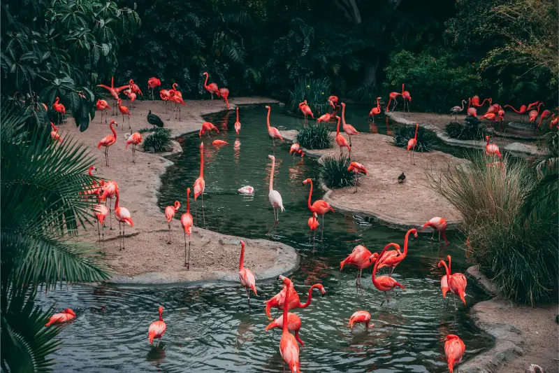
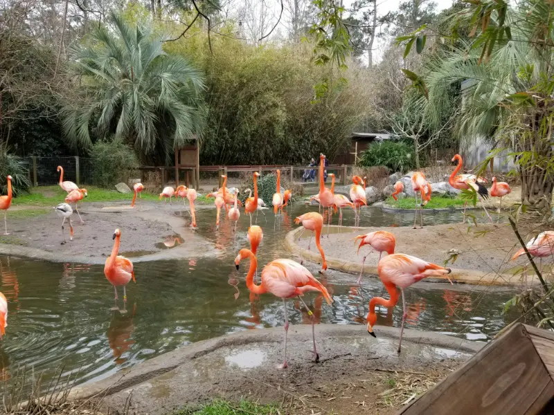
    Flock of Flamingos at Florida Wildlife Park

    Observe alligators, snakes and other wildlife from a generous distance. Never feed animals, approach a nest, or stop on a road in a way that endangers people or wildlife. Keep pets close and prevent them from entering sensitive areas. If you find an injured animal, do not improvise a rescue; contact authorized staff. A respectful visitor may see fewer dramatic close-up scenes than someone who behaves irresponsibly, but leaves the refuge in better condition for future visitors.

    Planning a day with children, teenagers and seniors

    For younger children, make the outing about looking and listening. Short stops near the visitor center and a drive along Lighthouse Road may be sufficient. Explain in advance that there are no guaranteed dolphin, alligator or bird sightings, and that animals should not be chased. Provide shade, snacks and insect protection. A child who has enjoyed a museum’s interactive display may need time to adapt to a protected landscape where the reward is observation.

    Teenagers interested in science or photography can keep a habitat diary noting how plants and birds change along the road. Older visitors may appreciate the slow pace, but should not be asked to walk long exposed levees without breaks. Check toilet locations before beginning the route. If a traveler depends on wheelchair access or has heat sensitivity, call the visitor center to discuss specific observation areas. The refuge is valuable precisely because it offers different ways to connect with nature without demanding the same activity from everyone.

    Weather, storms and the Gulf Coast

    The exposed wetlands offer little protection during a thunderstorm. Watch the forecast and turn back from open water or tall, isolated structures when lightning approaches. After periods of heavy rain or strong wind, roads and trails may be damaged or temporarily closed. Hurricanes and tropical storms can affect refuge operations far beyond the day of the storm; confirm reopening before a long drive.

    In summer, heat can become dangerous even on an outing based around a vehicle. Keep extra drinking water in the car, use sun protection and never leave a child or pet inside a parked vehicle. Mosquitoes and other biting insects can be intense around marshes, especially near dawn and dusk. Long sleeves, appropriate repellent and flexible timing make the day more pleasant. If you have only one chance to visit, choose the best safe-weather window rather than rigidly following a prebooked schedule.

    Suggested first-visit route

    Start at the visitor center when it is open and ask about current closures. Drive Lighthouse Road slowly, stopping at one or two designated wildlife-viewing points. Choose a short trail that suits your group’s abilities, then continue toward the lighthouse area if the road is open. Save time to watch the landscape rather than driving straight to the southernmost point and back. Finish early enough to return before darkness and avoid a hurried drive through wildlife habitat.

    Do not overfill the same day with unrelated attractions. The refuge can pair with a relaxed meal in the St. Marks area or a separate visit to Wakulla Springs on another day, but driving between remote sites consumes time. For those staying in Tallahassee, the refuge makes an excellent half-day or longer nature escape. The most important planning choice is selecting a manageable amount of trail walking and enough time to appreciate the road and coastal setting.

    Planning table

    Topic Practical tip
    Base Visitor center on Lighthouse Road, south of Tallahassee
    Entrance Fee required; verify current pass and gate details
    Signature drive Lighthouse Road through marshes and pools
    Lighthouse interior Tour access varies; confirm directly
    Wildlife Binoculars and patience; no guaranteed sightings
    Safety No swimming, no drones and no collecting
    Best comfort Cooler months; strong summer insect and heat precautions

    Frequently asked questions

    Is the St. Marks Lighthouse always open for climbing or tours?

    No. Exterior viewing and interior tour access are different. The official refuge page advises checking its events schedule or calling the visitor center for current lighthouse arrangements.

    Can you swim at St. Marks National Wildlife Refuge?

    No. Refuge rules prohibit swimming. This is a wildlife protection area, not a designated swimming beach.

    Do you need a long hike to see wildlife?

    No. Visitors can observe habitat from legal stops along Lighthouse Road and selected short routes. Longer trails are available when open, but not required for a satisfying first visit.

    Are dogs allowed?

    The refuge’s visitor information permits leashed pets under applicable rules. Keep pets away from wildlife and respect any signed trail or seasonal restrictions.

    Is there a best time of year for birdwatching?

    Late fall through early spring generally brings more comfortable walking weather and interesting seasonal bird activity. Species sightings depend on migration, water levels and daily conditions.

    Official planning resources

    Use the U.S. Fish and Wildlife Service’s St. Marks refuge visitor page, trail information and main refuge page to plan responsibly. St. Marks is a place to slow down: choose a clear-weather day, watch from an appropriate distance and let the coastal habitats rather than a checklist determine what makes the visit memorable.

  • Shell Mound Cedar Key Guide: Archaeological Trail, Dennis Creek, Wildlife and Visitor Tips

    Shell Mound Cedar Key Guide: Archaeological Trail, Dennis Creek, Wildlife and Visitor Tips

    Shell Mound is one of the most distinctive short trips from Cedar Key because it combines archaeology, salt-marsh scenery and refuge wildlife in one compact area. Located in the Shell Mound unit of Lower Suwannee National Wildlife Refuge, the archaeological feature was built over thousands of years from discarded shells and other cultural material. Today the mound is protected and explored only on foot.

    Explore this guide

    Plan 2 to 3 hours for the Shell Mound Trail, nearby Dennis Creek Trail or observation/fishing areas. The refuge is open sunrise to sunset, and the experience is free, but it is remote enough that water, insect repellent and a downloaded map should be treated as essentials.

    Quick planning summary

    • Location: Shell Mound unit, roughly 9 miles north of Cedar Key
    • Hours: refuge outdoor areas sunrise to sunset
    • Shell Mound Trail: approximately 0.3-mile loop in FWS visitor material
    • Dennis Creek Trail: approximately 1 mile nearby
    • Archaeological significance: about 6,000 years of accumulation and use
    • Best for: archaeology, birding, photography, short walks and travelers who want a meaningful low-cost half-day

    Important current-status note

    October 2026 information snapshot: this article is scheduled for 2028, so hours, fees, storm recovery, trail conditions, ferry or boat access, museum schedules and wildlife closures should be checked again shortly before travel. Cedar Key and the lower Suwannee coast are low-lying, tide-driven places where weather and restoration work can change practical access faster than in a large city destination.

    What makes the mound important

    FWS describes the mound as an ancient feature begun by Archaic cultures and continued by Woodland-period peoples. It was created over a very long period from oysters, clams and other materials. Before federal refuge protection, parts of the mound were used as a source of road material. Today it is protected from all but foot traffic.

    Walking the Shell Mound Trail

    The loop is short enough for many families and older travelers, but the interpretive value is higher if you slow down. The landscape is not dramatic in the theme-park sense; the significance comes from understanding that the elevated ground under your feet is cultural history built across millennia.

    Dennis Creek and coastal views

    If weather and energy are good, add the nearby Dennis Creek Trail for a longer walk through coastal habitat. FWS visitor material also notes an observation/fishing pier in the Shell Mound area. This is a good place to stop moving and watch tides, birds and marsh rather than treating the visit as a mileage goal.

    Respecting an archaeological site

    Do not collect shells, artifacts or other material. A shell fragment that looks ordinary may be part of the protected site. Keep children on the route, avoid digging or moving objects, and use photographs instead of souvenirs. The same rule applies throughout refuge lands where collecting plants, animals, shells and artifacts is prohibited.

    Official information

    Use the Lower Suwannee National Wildlife Refuge visitor page and current refuge map for directions and closures.

    Flock of Flamingos at Florida Wildlife Park

    Planning the visit for different ages

    This part of Florida can work very well for mixed-age groups, but the best activity is not always the most adventurous one. Babies and toddlers usually need shade, predictable restrooms and short outdoor blocks; school-age children often enjoy wildlife spotting and simple museum stories; teenagers tend to appreciate paddling, photography and less structured time; older travelers often prefer scenic drives, boardwalks, museums and short trails. Build the day around the least flexible traveler and let everyone else add optional activities around that core plan.

    Weather, tides and the best season

    Late fall through spring usually brings the most comfortable temperatures for walking, birding and exploring historic sites. Summer is hot, humid and storm-prone, with mosquitoes and no-see-ums often more noticeable near marshes. Tropical weather can affect Cedar Key and the Nature Coast from summer into fall. On any coastal day, check radar, tide, wind and local alerts before committing to a long paddle or remote trail, and carry more drinking water than you think you will need.

    Tides matter here in a way they do not on many inland Florida trips. A shoreline, creek or launch that looks easy at high water can become muddy, shallow or difficult at low tide. If your day includes paddling, fishing or island access, look at a local tide table and ask the outfitter or refuge staff how the tide changes the route. For land-only sightseeing, tides are less critical but still shape wildlife viewing and the look of the marsh.

    Accessibility and low-effort alternatives

    Accessibility varies sharply from paved museum grounds to natural-surface refuge roads and sandy trails. Before traveling with a wheelchair, walker or stroller, check the official accessibility notes for the specific site rather than assuming a short trail will be smooth. A useful low-effort backup in this region is to combine a museum, a scenic waterfront drive and a meal instead of forcing a trail when heat, mobility or weather makes it a poor choice.

    What to bring

    • Refillable water bottles and a small cooler for remote sites
    • Sun protection, hat and sunglasses even in winter
    • Insect repellent for marsh and forest stops
    • Closed shoes for shell, sand and uneven trail surfaces
    • A lightweight rain layer in warm months
    • Binoculars for birds and dolphins
    • A paper or downloaded map when cell coverage may be weak
    • Dry bag or waterproof pouch if the day includes boats or kayaks

    How to combine it with nearby places

    Shell Mound is best paired with a focused Lower Suwannee refuge drive or a return to Cedar Key for lunch. Avoid stacking it with a long spring visit on the same afternoon if your group tires easily in heat.

    Common planning mistakes

    • trying to schedule too many remote sites in one day
    • assuming every natural area has food, shade and full-service restrooms
    • ignoring tide, heat or storm conditions because the route looks short
    • arriving late at a site with limited museum days or early closing
    • treating wildlife sightings as guaranteed
    • forgetting that storm recovery can change access for months or years

    Final planning advice

    The best trips on this stretch of the Nature Coast are intentionally unhurried. Choose one anchor activity, add one nearby secondary stop, and leave room for weather, wildlife, a longer lunch or an unexpectedly good sunset. That rhythm is more realistic than building the day like an Orlando attraction schedule, and it fits the character of Cedar Key and the lower Suwannee coast much better.

    Pink Flamingos at Florida Wildlife Pond

    Decision guide: is this stop right for your trip?

    Choose this stop when it matches the purpose of the day rather than because it appears on a “must-see” list. Cedar Key and Levy County reward selective planning. History-focused travelers should prioritize museums and archaeological sites; wildlife travelers should spend more time in refuges; families often do best with one educational stop plus outdoor time; active travelers can build the day around paddling or longer trails. If the attraction duplicates something your group has already done elsewhere in Florida, use the time for a slower meal, sunset or a different habitat instead.

    Budget also includes time, fuel and comfort. A free refuge can cost more in planning effort than a small paid museum because you need water, navigation and a longer drive. Conversely, a low admission fee does not make a museum worthwhile if you arrive fifteen minutes before closing. Compare the total experience—not just ticket price—when deciding what deserves a place in a short itinerary.

    A practical pre-trip checklist

    • Confirm the official opening status on the morning of the visit.
    • Check radar, heat index, wind and tide when the day includes exposed coast or water.
    • Download directions before leaving the town center.
    • Carry water and snacks when heading into refuge or state-reserve areas.
    • Tell someone your route if paddling or hiking away from developed areas.
    • Keep one flexible alternative that does not depend on the same weather condition.

    This simple checklist is especially useful for multigenerational trips. It turns the day from a sequence of optimistic assumptions into a plan that can absorb closures, heat, fatigue or weather without feeling ruined.

    Practical comfort and pacing

    A useful way to judge the pace is to count transitions rather than attractions. Every time the group moves from car to trail, trail to museum, museum to lunch or dry clothes to swim gear, the day loses time and energy. Families with small children and older travelers feel those transitions most. Two well-chosen stops with a real lunch break usually produce a better day than four stops connected by hurried parking and short walks.

    Plan shade and restroom breaks before they become urgent. In small Nature Coast communities, a remote trailhead may have basic facilities while the next reliable restroom is several miles away. Keep drinking water in the vehicle, do not leave electronics or food exposed to heat, and change into dry clothing before a long drive after swimming. These details sound minor, but they are what separate a relaxed day from one that feels harder than the destination deserves.

    How this stop fits a longer Florida road trip

    On a longer itinerary, Cedar Key and Levy County work best as a deliberate change of pace between larger Florida destinations. Do not treat the area as a quick detour squeezed between two long drives. If you are coming from Gainesville or Ocala, arrive early enough to enjoy the coast before sunset. If you are continuing toward Crystal River, leave the following morning rather than driving south after a full outdoor day. That gives the Nature Coast enough time to feel distinct instead of becoming scenery through the windshield.

    For travelers covering Florida over one or two weeks, alternate active and easy days. A paddling or hiking day here can follow a museum-heavy city day, while a quiet Cedar Key museum-and-waterfront day can serve as recovery after springs, long drives or theme parks. The destination is most valuable when you use its slower rhythm intentionally.

  • Southwest Florida Wildlife Photography: Five Days from Corkscrew Swamp to Sanibel and Big Cypress

    Southwest Florida Wildlife Photography: Five Days from Corkscrew Swamp to Sanibel and Big Cypress

    Southwest Florida rewards patient wildlife photographers who enjoy changing light, wetland landscapes and quiet observation more than dramatic close-ups at any cost. The region’s protected habitats can reveal wading birds, dolphins, alligators, mangroves, bald cypress, insects and seasonal migrants, but nothing is guaranteed. This five-day circuit uses Naples and the Fort Myers area as practical bases, with Corkscrew Swamp Sanctuary, the Ten Thousand Islands region, Big Cypress National Preserve and Sanibel Island as anchors. The plan works for dedicated cameras or smartphones and can be adapted for a traveler who prefers flat paths and a short walk. Wildlife welfare and refuge regulations must always come before a photograph.

    What makes photography here different

    Southwest Florida combines freshwater swamps, brackish estuaries, mangroves, coastal islands and open wetland edges. Each habitat produces different photographic conditions. Cypress forests can be dim, while exposed boardwalks have intense midday reflections. A lens suited to a distant bird is not automatically suitable for a sweeping mangrove landscape. Think in sequences: one broad view to show habitat, one medium view of an animal in context, and only a closer photograph if the animal’s natural behavior and the site rules allow it.

    The best trip is not measured by how many species you photograph. Watching a heron hunt for several minutes can teach more than chasing a moving bird from one parking lot to the next. Never bait animals, use recorded calls without permission or block their movement for a close image. Wildlife refuges explicitly discourage disturbance, including forcing birds to fly. Keep natural vegetation and the dignity of other visitors in mind. A long lens or a crop from a safe distance is far better than an unsafe approach to a nesting bird, alligator or manatee.

    Pink Flamingos at Florida Wildlife Pond

    When to visit and what equipment to carry

    Cooler months generally make extended observation more pleasant and can bring seasonal bird activity. Summer may offer dramatic skies and lush vegetation but also storms, humidity, insects and heat stress. Sunrise can deliver soft light and active animals, although entrance hours at individual sites may begin later. A plan for “golden hour” is useless if the protected area is closed then. Verify daylight access and any timed ticketing. Bring a reusable water bottle, sun protection, shoes with traction and a lightweight rain cover for the camera.

    A moderate telephoto lens is helpful for birds, but a smartphone with a steady hand and patient framing is enough for habitat photographs. Avoid heavy gear if it forces you to leave the trail or makes long boardwalks exhausting. A small dry bag can protect equipment during tropical rain; a waterproof cover does not make the photographer immune to lightning. Bring binoculars even if you have a long camera lens. Watching first and photographing second often leads to more interesting composition and fewer attempts to push too close.

    Day one: Corkscrew Swamp Sanctuary near Naples

    Begin with Corkscrew Swamp Sanctuary, an Audubon destination northeast of Naples known for its boardwalk through wetland and old-growth bald cypress habitat. Review the official sanctuary planning page for current admission, operating hours and conditions. Its boardwalk is a major part of the experience and is designed to be accessible, but the full circuit can be longer than a visitor with limited stamina wants. Choose a manageable distance and do not rush; morning sounds and the shapes of the trees are as important as a rare animal sighting.

    Pay attention to reflected light under the canopy. The contrast between bright sky and dark trunks may be greater than a camera can capture in one exposure; exposing for highlights and accepting some shadow is often better than producing an unnatural image. Look for repeated cypress shapes, the reflection of leaves and the changing color of water. Ask staff about recent sightings rather than assuming old social media reports are current. Lunch and a rest in Naples make an appropriate end to the first day, especially for families or older travelers.

    Day two: Ten Thousand Islands marshes and careful boat choices

    Spend day two around the Ten Thousand Islands National Wildlife Refuge and its accessible mainland observation options. The US Fish and Wildlife Service describes a Marsh Trail and observation tower, while much of the refuge is most naturally visited by water. It **does not itself operate kayak rentals or guided tours**, so an operator claiming to be the official refuge guide should be checked carefully. The refuge visitor information explains public access and facilities. Use the mainland trail for a low-impact morning if wind or boat logistics are unsuitable.

    A guided boat excursion can offer different perspectives on mangrove shorelines and birds, provided it follows boating regulations and wildlife approach limits. Ask about group size, speed, shade, restroom access and cancellation conditions. Choose an operator who describes ecological interpretation and avoids chasing dolphins or approaching nesting habitat for photographs. From a moving boat, stabilize your camera safely without leaning over railings. Keep camera straps secure and protect gear from spray. An unhurried marsh-tower session can be more productive than a high-speed boat trip if your main interest is bird behavior.

    Day three: Big Cypress boardwalks and swamp landscapes

    Travel the Tamiami Trail through Big Cypress National Preserve, stopping at official visitor areas and boardwalks. The National Park Service accessibility page describes accessible visitor centers and wildlife-viewing options. Before targeting Kirby Storter Boardwalk, note that park notices have reported partial access limitations after a 2025 fire; verify its present status rather than relying on an older description that calls the full route open. H. P. Williams and the visitor-center boardwalks can provide alternatives when one route is restricted.

    Pink Flamingos Standing in Florida Wildlife Park

    The swamp offers quiet photographic opportunities that do not depend on approaching reptiles. Focus on cypress knees, layers of vegetation and reflections. Alligators are wild animals; never stand between an animal and the water or feed one for an image. Carry insect protection and drink water even on cool days. Roadside shoulder stopping is dangerous on US 41, particularly when traffic is fast. Use marked pull-offs. If a thunderstorm develops, return to the vehicle or a safe building rather than continuing along an open boardwalk because the clouds look dramatic.

    Day four: Sanibel and Ding Darling refuge

    Drive to Sanibel Island for J. N. “Ding” Darling National Wildlife Refuge. Its Wildlife Drive is a popular route for birds and coastal wetland photography. The official refuge visitor page states that Wildlife Drive is **closed on Fridays**, a critical detail for a five-day itinerary. Check current reopening or repair notices for facilities, since storm recovery can affect some trails. The drive’s slow speed encourages observation from designated stopping points without stepping into sensitive habitat.

    Try to work with the light rather than choosing a species first. During suitable tidal conditions, mudflats may attract feeding shorebirds, but tidal cycles and seasonal patterns vary. Ask staff about the best legal observation opportunities on your particular day. Use a long focal length for a spoonbill or egret, leaving generous space around the animal. If a bird stops feeding, repeatedly looks at you or moves away, increase distance. Finish with an easy island meal and a sunset landscape from a permitted public access, not a blocked private driveway or dune crossing.

    Day five: optional return to a favorite habitat

    The final day should be flexible rather than another high-mileage transfer. Serious photographers often learn more by returning to the sanctuary that produced the most interesting conditions. If day one was overcast, a second look at Corkscrew can reveal new textures. If Sanibel was windy, spend longer on a calm protected path. Families can choose a short beach visit or an indoor nature exhibit instead. A traveler with limited mobility can revisit a known accessible deck without needing to explore miles of new trail.

    Review photographs in the afternoon. Organize them by habitat, date and location and record what you actually observed. A blurry image of a bird you cannot identify should not be published with a confident species label. Use a field guide, credible birding reference or a qualified local expert when necessary. Do not share sensitive nesting coordinates or real-time locations of protected animals if that could encourage crowding. A responsible photo journal can communicate why wetland conservation matters without advertising secret wildlife sites.

    Birdwatching etiquette, drones and animal safety

    Do not use flash at close range on sensitive nocturnal wildlife, and follow the specific rules of each sanctuary and refuge for tripods, commercial filming and drones. A national wildlife refuge is not an unregulated drone-flying space. Many protected areas restrict unmanned aircraft and filming that affects visitors or wildlife. Pets may also be restricted; Corkscrew, for example, does not allow ordinary pets on its boardwalk. Check service-animal guidance if relevant. Never enter closed sections to obtain a new angle.

    Photographing alligators, dolphins and manatees requires restraint. Do not lure animals with food or sound. Observe from a safe distance and never approach a mother and young. In water, follow local boating and paddling guidance, maintain safe distance and understand that a wildlife sighting may be brief. If using a polarizing filter or looking through a long lens, remain aware of your position and approaching people. Photography is a privilege in a shared conservation setting, not a reason to ignore safety instructions.

    Where to stay and how to pace the driving

    Use Naples for nights one through three, then the Fort Myers or Sanibel area for one or two nights. Naples provides access to Corkscrew and Big Cypress, while Sanibel is more convenient for an early refuge visit. Driving through the region can be slow during winter seasonal tourism, particularly over island causeways. Avoid scheduling a nonrefundable boat excursion immediately after a long drive. A room with easy parking, a secure place for equipment and an early breakfast can be more valuable than a view from the highest floor.

    For wheelchair users, check the actual path between parking, restroom and observation area; a site that advertises an accessible boardwalk may still have unavailable segments or nearby unpaved parking. Family groups should bring child-friendly binoculars and select short assignments instead of expecting hours of silence from toddlers. Those traveling alone should let someone know their plan before entering remote areas. Cell service can be inconsistent, and a scheduled check-in is a sensible safeguard during field photography.

    Budget, fees and equipment decisions

    This route’s largest expenses are lodging, car rental and any paid excursions. Corkscrew requires admission, wildlife drives may have entry fees and professional boat trips can be expensive. A visitor with a phone and binoculars can still enjoy excellent natural history observation with no new camera purchase. Renting a lens for a few days may be more rational than buying costly gear before learning the conditions. Compare cancellation terms for storm-prone months and keep a free inland or museum alternative ready.

    Avoid adding multiple paid boat rides because one sighting was disappointing. Animals cannot be scheduled, and repeated disturbance harms the very habitats you came to enjoy. Small donations to conservation organizations or purchases from visitor-center shops can support interpretation, but they should not buy privileged access to restricted areas. Photography is often better after a second visit to an accessible location because you know where light falls and how long it takes to walk from parking.

    Five-day field schedule

    DaySiteBest focusConfirm first
    1Corkscrew SwampCypress forest and boardwalk wildlifeOperating hours and ticketing
    2Ten Thousand IslandsMarsh birds and mangrove landscapeBoat operator or mainland trail status
    3Big CypressCypress strands, water reflectionsBoardwalk repair and road notices
    4Ding Darling, SanibelWading birds and estuaryWildlife Drive not Friday
    5Favorite siteRepeat in better lightWeather and available access

    Frequently asked questions

    What is the best month for wildlife photography in Southwest Florida?

    Cooler months are generally comfortable and often good for seasonal birds, but sightings depend on weather, tides and habitat. There is no guaranteed wildlife calendar.

    Do I need a long professional lens?

    No. Binoculars, a smartphone and good observation habits can produce engaging habitat images. A longer lens helps with distant birds without approaching them.

    Can I drive through Ding Darling on Friday?

    The refuge’s official visitor information says Wildlife Drive closes on Fridays. Check for updated schedules and other permitted refuge areas before visiting.

    Are all Big Cypress boardwalks fully open?

    Do not assume so. Some have experienced repair or fire-related restrictions. Consult the National Park Service’s current notices and choose an accessible alternative if necessary.

    Will a guided boat trip guarantee dolphins or birds?

    No ethical operator can guarantee wild animal behavior. Choose a safety-conscious interpreter and treat sightings as an opportunity rather than an entitlement.

    Official field references

    Read Audubon's Corkscrew Swamp guidance, Ten Thousand Islands refuge visitor information, Big Cypress accessibility updates and Ding Darling visitor rules. Prepared October 2026; seasonal hours, refuge closures and repair notices change.

  • Winter Birding on Florida’s Atlantic Coast: Six Days from St. Augustine to Palm Beach

    Winter Birding on Florida’s Atlantic Coast: Six Days from St. Augustine to Palm Beach

    Florida’s Atlantic coast offers excellent opportunities to look for coastal and wetland birds during the cooler months, but successful birding requires more than a list of famous species. Tides, weather, seasonal migration and protected-habitat rules shape what a visitor may see. This six-day itinerary follows a southbound route from St. Augustine toward Merritt Island, Vero Beach and Palm Beach County, mixing wildlife drives with accessible boardwalks and town breaks. It is designed for beginners carrying binoculars, photographers working with long lenses, families introducing children to nature and older visitors who prefer shorter walks. No particular bird is guaranteed, and the itinerary deliberately avoids advice that would disturb nesting or feeding wildlife.

    Why winter is useful for Atlantic Coast birding

    Cooler weather makes repeated outdoor stops more pleasant and brings migratory waterfowl and other seasonal visitors to parts of Florida. Yet “winter birds” do not all arrive on the same day, and not every marsh becomes more active in December than in March. Rainfall, cold fronts, tide levels and habitat management matter. Winter can also bring busy roads and full parking lots in coastal towns. A birding trip is most flexible when you plan habitat visits rather than guaranteed species: estuaries for shorebirds, managed wetlands for waders and open-water edges for waterfowl.

    Start with binoculars and a field guide or reputable identification app; a camera is optional. Learn to observe posture, bill shape, color pattern and behavior before attempting an identification. Many herons and egrets change plumage with age, and distant birds can look misleadingly similar. A child may find “count three different feeding styles” more engaging than a competition to identify twenty species. An older visitor can enjoy a single productive observation platform without needing to walk a long trail. Patient observation is a legitimate way to experience the Atlantic coastal landscape.

    Day one: St. Augustine and protected coastal habitats

    Begin with an arrival and orientation around St. Augustine, choosing a legal public shoreline observation point or a visit to a coastal research reserve where visitor facilities are open. The Guana Tolomato Matanzas National Estuarine Research Reserve, often shortened to GTM, is an important resource for understanding coastal ecology in this region. Before arriving, confirm its current visitor-center schedule, trail regulations and any storm-related closures. Do not assume every tract can be reached from the same parking lot. Estuaries are made of connected habitats but can have very different roads and access points.

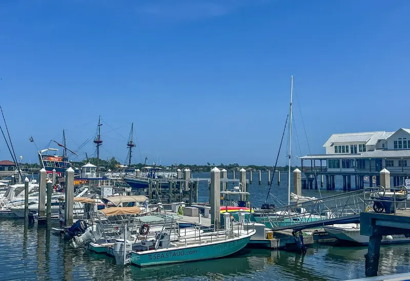
    Sailing Boats in Saint Augustine Florida Marina

    A short late-afternoon observation can reveal how tides influence shorebird feeding and why salt marshes matter to migrating animals. Stay on designated boardwalks or trails and never walk into nesting areas. Bring insect repellent even during cooler months, since mosquitoes are not strictly a summer concern. The first evening is a good time to practice identifying common shapes—egrets, gulls, cormorants or terns—without worrying about a complete checklist. Rest in St. Augustine or farther south only after checking the next day’s driving distance.

    Day two: coastal wetlands and a comfortable transfer

    Use the second morning for another St. Augustine-area habitat or for a nearby nature walk that is officially open. Wildlife tends to be easier to observe when you arrive early and limit noise, but a spectacular sunrise is not required. If you are photographing birds, do not pursue a moving flock from one parking lot to another. Watch what the animals do before you lift the camera. Moving slowly also helps prevent a common error: walking close enough to flush shorebirds from a feeding area simply to obtain a better image.

    In the afternoon, drive south toward Titusville and the Space Coast. This is a transfer, not a second full birding day. Choose accommodation with easy morning access to Merritt Island National Wildlife Refuge, and check NASA-related area notices before setting an exact arrival time. The refuge overlaps Kennedy Space Center land, and operational restrictions can affect roads and visitor facilities. Keep food and water available because birding destinations are not always close to restaurants. Review your observations in the evening and prepare binoculars, hats and sun protection for the next morning.

    Day three: Merritt Island's Black Point Wildlife Drive

    Merritt Island National Wildlife Refuge is a core stop because its Black Point Wildlife Drive provides a slow vehicle-based route through managed marshes. The federal refuge’s visitor information confirms that an entry pass is required for certain areas, and access may change during launch operations. Download or collect current visitor materials and drive patiently, pulling over only at permitted stops. Watch for wading birds along water margins, raptors overlooking marshes and waterfowl in suitable season.

    The route is particularly useful for travelers with limited walking endurance, although some viewing stops require different amounts of mobility. The visitor-center boardwalk is identified by the refuge as the wheelchair-accessible route among its listed trails, while other surfaces may be mowed grass or uneven ground. Ask rangers about conditions instead of assuming every tower is reached by pavement. Do not block the wildlife drive to take photographs from the middle of the road. A slow morning with frequent short pauses can be more productive than a long hike that disturbs birds.

    Day four: Pelican Island near Vero Beach

    Continue south to Pelican Island National Wildlife Refuge, America’s first national wildlife refuge. The official Pelican Island visitor page describes observation opportunities and an accessible Centennial Trail leading toward views of the protected island. This is a place to appreciate conservation history as well as birds. Do not assume the island itself is a visitor destination where you may land. Its value lies partly in protecting habitat from exactly that kind of disturbance.

    Spend time on the boardwalk and watch how birds use the lagoon at different water levels. A spotting scope or telephoto lens makes it easier to view distant individuals without leaving the permitted route. Other refuge trails may be longer or have different surfaces; choose them only if they fit your group’s ability and the weather. Carry water because an open observation platform can feel hot even during winter. If traveling with school-age children, invite them to draw a simple map of the refuge and note why an area can be protected while still allowing visitors at designated observation points.

    Day five: the Indian River Lagoon and a move to Palm Beach

    Use the fifth day as a flexible coastal exploration and transfer toward Palm Beach County. The Indian River Lagoon is a large, diverse estuary, but wildlife habitat and access conditions change along its length. Choose one publicly permitted observation site rather than stopping at every water-facing road. Shorebirds may be far away at high tide or grouped in places that are closed to pedestrians. A quiet hour observing from a legal deck is more valuable than approaching a roost on a sandbar. Respect signs protecting turtles and sensitive coastal vegetation.

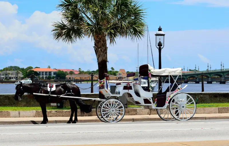
    Horse Drawn Carriage in Saint Augustine Florida

    Plan lunch and drive time deliberately. Highway traffic near growing coastal towns can consume much more of a day than a map suggests. If you want to add a beach stop, first check local water and weather advisories; birdwatching does not require entering the ocean. For wheelchair users, review the exact distance from parking to the chosen platform. If a grandparent or younger child is tired, use the afternoon for accommodation check-in and a short local walk. Good birding often depends on returning alert the following morning.

    Day six: constructed wetlands and South Florida birdlife

    Finish in Palm Beach County with a visit to a managed wetland or boardwalk where public access and current conditions are confirmed. Wakodahatchee Wetlands and Green Cay are well-known examples of accessible-style birding experiences, but individual boardwalks, parking and opening conditions can change. Verify county notices before choosing a route, and do not assume that every platform will be usable after maintenance or storm damage. These settings offer a chance to compare human-managed freshwater wetlands with the estuarine habitats farther north.

    Observe from established paths and keep a respectful distance from nests. In a popular wetland, photographers sometimes gather near a single bird; do not form a crowd that blocks wheelchair users or strollers. Put the camera away occasionally and listen to calls or look for smaller birds among vegetation. A final day can be as brief as one careful walk followed by a leisurely meal. If returning to an airport, leave enough time to avoid making the final boardwalk a frantic rush.

    Birding etiquette and conservation rules

    Never use food, sound recordings or flash to manipulate wildlife unless the land manager expressly permits an activity; in many situations the ethical choice is simply not to do it. Do not attempt to relocate or handle chicks, eggs or injured birds. Contact appropriate wildlife authorities if there is a genuine concern. At sensitive nesting sites, follow seasonal closures even if a path appears empty. A protected island may hold important breeding habitat beyond the view of tourists. Viewing from a distance is part of successful wildlife travel, not a failure to get close.

    Use tripods only where allowed and keep them clear of narrow boardwalks. Families should make space for people moving more slowly and teach children not to chase birds. Dogs are restricted in some refuges, while genuine service-animal rules are different; check the site-specific policy. If you record an unusual bird for a public checklist, think carefully before posting a precise location that could attract crowds during sensitive nesting periods. Shared observations can contribute to knowledge without turning conservation land into a competitive spectacle.

    Photographs, notebooks and species identification

    A simple notebook with date, site, weather, tide if relevant and rough behavior observations is more useful than a long unsorted list of guesses. Binoculars allow closer views without disturbing birds, while a field guide can help separate common egrets or shorebirds. Take a few photographs of habitat context as well as close-ups; these help reconstruct where the bird was feeding. If uncertain of a species, record that uncertainty rather than inventing a confident label. Birdwatching is a learning practice, and expert birders make corrections too.

    Beginners can use a short target list based on common forms rather than rare sightings. Look for a tall white wader, a dark diving bird, a soaring raptor and a small shoreline runner. Compare feeding behavior and bill shape. Do not force identification through binoculars when the bird is too distant. A volunteer or ranger may help if available. For children, allow regular breaks and an age-appropriate challenge such as drawing a bird’s posture rather than keeping them quiet for hours.

    Seasons, tides, storms and morning schedules

    Winter has comfortable periods but is not free of storms, wind or cold mornings. Layer clothing and keep a rain plan. Bird concentrations can change with water depth, tidal cycles and maintenance of managed impoundments. A single quiet morning does not mean a refuge has no birds. If a cold front passes, watch for changes in bird activity but do not stand on an exposed platform during lightning. The official operating schedule is more important than an idealized sunrise photograph; gates may open after daylight begins.

    In summer, birding is still possible but heat and mosquitoes can shorten outings, and sea turtle nesting may affect beach access. If visiting during hurricane season, respect emergency closures and avoid remote roads after heavy rain. A six-day itinerary should have at least one flexible afternoon in case weather removes a planned stop. Those wishing to photograph particular species should research migration patterns and permits more deeply, but a general-interest birding vacation can succeed without exact seasonal predictions.

    Accommodation, driving and accessibility

    A practical arrangement is one or two nights near St. Augustine, two around Titusville and the Space Coast, one near Vero Beach and one in Palm Beach County. This requires several hotel changes. If that sounds tiring, shorten the trip and concentrate on Merritt Island and Pelican Island from two bases. A rental car makes the route much easier; public transit rarely takes you directly to scattered refuge trailheads early in the morning. Check parking fees and entry requirements rather than expecting every wildlife stop to be free.

    For wheelchair users, seek named accessible paths and ask about maintenance. A refuge’s “flat trails” may still be grassy or unpaved; the difference can determine whether a visit works. Families with preschoolers may choose one short boardwalk and a nearby lunch rather than a full-day photography session. Older visitors can favor wildlife drives, shaded observation areas and morning breaks. There is no single correct way to be a birder, and physical endurance is not a prerequisite for enjoying protected wetlands.

    Six-day birding table

    DayAreaHabitatPriority check
    1St. AugustineEstuary and coastal reserveSpecific GTM visitor access
    2St. Augustine to TitusvilleOptional shorebirds and transferTravel time
    3Merritt IslandManaged marshes and wildlife driveRefuge pass and launch closures
    4Pelican IslandLagoon and protected rookery viewsBoardwalk and trail conditions
    5Indian River LagoonPublic coastal observation sitesLegal access and tide
    6Palm Beach CountyManaged freshwater wetlandsCurrent boardwalk notices

    Frequently asked questions

    Is December better than February for birdwatching?

    Both can be rewarding, with different weather and bird activity. Exact species depend on migration, tide and habitat rather than a guaranteed calendar date.

    Can we visit Pelican Island itself?

    The refuge protects the island, which is viewed from designated public trails and observation points. Do not assume landing or entering nesting areas is permitted.

    Can a beginner follow this itinerary without a guide?

    Yes, with binoculars, official site maps and modest expectations. A ranger program can enrich the experience when offered, but independent observation at designated sites is worthwhile.

    Is this itinerary suitable for wheelchair users?

    Some highlighted refuges have identified accessible routes or driving opportunities. Check the specific surfaces and closures; do not assume all trails at each refuge are accessible.

    Do I need a big camera to enjoy the birds?

    No. Binoculars and a notebook are enough. Birdwatching values observation and conservation, and an ethical distant view matters more than a close image.

    Official birding references

    Review Merritt Island refuge visitor information, the Pelican Island refuge guide, and the US Fish and Wildlife Service wildlife-watching guidance. Prepared October 2026; public access, tides and weather conditions must be reconfirmed.

  • Best National Wildlife Refuges in Florida: Manatees, Birds, Sea Turtles and Wild Landscapes

    Best National Wildlife Refuges in Florida: Manatees, Birds, Sea Turtles and Wild Landscapes

    Florida’s national wildlife refuges protect some of the state’s most important habitats, yet many visitors drive past them on the way to better-known attractions. These refuges can deliver extraordinary birding, manatee viewing, sea turtle conservation, quiet beaches, scenic drives and wetland landscapes without the scale or crowds of a major theme park. They are managed first for wildlife, which means the visitor experience can include seasonal closures, limited facilities and changing access.

    I would choose a refuge based on the species and landscape you care about rather than trying to rank them only by scenery. Merritt Island is outstanding for Space Coast wildlife and birding, St. Marks combines Gulf wetlands with a historic lighthouse setting, Crystal River is central to winter manatee conservation, Loxahatchee protects northern Everglades habitat, and Archie Carr focuses attention on globally important sea turtle nesting beaches. Each one teaches a different version of Florida.

    Quick planning summary

    • Best all-around refuge for first-time wildlife watchers: Merritt Island National Wildlife Refuge.
    • Best Gulf Coast birding and scenic drive: St. Marks National Wildlife Refuge.
    • Best for manatee conservation: Crystal River National Wildlife Refuge.
    • Best for sea turtle habitat: Archie Carr National Wildlife Refuge.
    • Best planning principle: check the refuge website for current closures, fees, hunting seasons and access before leaving.

    In this guide

    Merritt Island National Wildlife Refuge

    Merritt Island surrounds much of Kennedy Space Center and protects a remarkable mix of lagoon, marsh, scrub and coastal habitats. Black Point Wildlife Drive is one of Florida’s best-known wildlife auto routes, particularly for birds, while trails and boat-launch areas expand the experience. NASA operations can occasionally affect access.

    Flock of Flamingos at Florida Wildlife Park

    This refuge pairs naturally with Titusville or a Space Coast stay, but I would avoid squeezing it into the same day as a rushed Kennedy Space Center visit unless wildlife is only a short add-on. Birding is strongest when you have time to stop, scan and wait.

    St. Marks National Wildlife Refuge

    South of Tallahassee, St. Marks offers marshes, coastal views, wildlife and a long scenic route toward the historic lighthouse area. The refuge is especially strong for birding, butterflies and seasonal migrations. Cooler months are comfortable, while summer can be hot, humid and insect-heavy.

    Use the visitor center or current online information to learn about road or habitat closures. Prescribed burns, nesting wildlife and management work are normal parts of a functioning refuge, not signs that the destination is failing.

    Crystal River National Wildlife Refuge

    Crystal River National Wildlife Refuge exists specifically to protect habitat important to the Florida manatee. During colder periods, warm spring water attracts manatees to Kings Bay and sanctuary areas. Visitor access is carefully managed because the animals need undisturbed refuge.

    Boardwalk viewing and responsible guided experiences can be excellent, but this is not a petting attraction. Follow sanctuary boundaries and current regulations. If the weather is warm and manatees are dispersed, enjoy the spring landscape without pressuring wildlife to produce a close encounter.

    Arthur R. Marshall Loxahatchee National Wildlife Refuge

    Loxahatchee protects part of the northern Everglades ecosystem near South Florida’s urban corridor. Boardwalks, marsh views, paddling and birding make it a useful Everglades experience for travelers staying around Palm Beach or Broward County without driving to the southern national park entrances.

    Sun and insects can be intense, and wildlife observation is best when you move slowly. A short visit can be rewarding, but paddlers and birders may want several hours. Check water access and trail conditions before arrival.

    Pink Flamingos at Florida Wildlife Pond

    Archie Carr and Pelican Island

    Archie Carr National Wildlife Refuge protects crucial sea turtle nesting habitat along Florida’s Atlantic coast, particularly around the barrier island south of Melbourne Beach. Much of the visitor experience is the beach itself and the conservation rules that protect nesting. Pelican Island, farther south near Vero Beach, is historically significant as the nation’s first national wildlife refuge.

    These are quieter destinations than a full-service park. Bring water, sun protection and realistic expectations about facilities. The reward is seeing how conservation fits into a developed coastline and why even small protected areas matter.

    Other refuges worth adding to a Florida road trip

    Lower Suwannee and Cedar Keys National Wildlife Refuges protect Nature Coast estuaries, forests and islands; Hobe Sound protects coastal habitat; St. Vincent is a remote barrier island refuge requiring boat access; and other refuge lands across the state create excellent regional stops. The right choice depends on your route and season.

    Remote refuges demand more self-sufficiency. Cell service can be limited, roads may be unpaved and facilities sparse. Download maps, respect gates and never assume a refuge road is open simply because a mapping app shows it.

    How to read refuge maps and seasonal notices

    Refuge maps often show a mixture of public roads, wildlife drives, trails, boat ramps, closed habitat and management areas. Do not assume every visible road is open to visitors. Seasonal notices may change access during nesting, hunting, prescribed fire or habitat work.

    Download the current map before leaving reliable mobile service. Pay attention to gate times; a wildlife drive that closes at sunset can become stressful if you enter too late. In winter, shorter daylight means the practical visitor window is smaller than the posted all-day concept suggests.

    Photography and birding etiquette

    Use a long lens or binoculars rather than approaching wildlife. Pull completely off travel lanes only where permitted, and never block a refuge road because a bird is close to the vehicle. Keep voices low at observation platforms and give other visitors room to watch.

    Birders benefit from arriving early and learning a few habitat clues rather than chasing every reported rarity. Families can focus on larger, easy-to-recognize species. The aim is to leave with a better understanding of the refuge, not a competitive species count.

    Families, seniors and accessibility

    Auto wildlife drives, short boardwalks and visitor centers are excellent for children because they allow frequent breaks. Give kids binoculars or a species checklist. Teenagers may enjoy photography, paddling or the connection between Merritt Island wildlife and nearby space history.

    Senior travelers and visitors with mobility needs should research accessible overlooks, restrooms and trail surfaces. Scenic drives can provide meaningful wildlife experiences without long walks. Remote boat-access refuges are less suitable unless the group is comfortable with the transfer.

    Best time to go

    Late fall through early spring is especially strong for birding and comfortable temperatures, while winter cold can concentrate manatees at warm-water refuges. Sea turtle nesting becomes important from spring into fall. Summer offers lush landscapes but more heat, thunderstorms and insects.

    Hunting seasons, prescribed burns and wildlife closures can affect access at some refuges. Always check the specific refuge rather than relying on a generic statewide calendar.

    Budget and booking

    Many refuge visits are low-cost, though selected roads, launches or areas may require passes or fees. Guided birding, paddling or boat access can add expense. If you already have a federal recreation pass, check whether it applies to the specific fee area.

    Spend on the equipment that improves observation and safety: binoculars, water, sun protection and a good map. Wildlife watching does not become better because the itinerary is expensive.

    How to build a realistic day

    Arrive early, drive or walk slowly, and limit the day to one refuge plus a nearby town or museum. Wildlife is most rewarding when you are willing to stop for ten minutes rather than racing to the next pin.

    Download the refuge map before arrival and note gate-closing times. In remote areas, start the return before you are tired or low on fuel.

    Common mistakes to avoid

    • Treating a wildlife refuge like a zoo with guaranteed sightings.
    • Entering closed habitat or sanctuary areas for a photograph.
    • Driving too fast on wildlife roads.
    • Assuming visitor centers and remote roads are open every day.
    • Feeding wildlife or approaching animals.
    • Planning remote refuge visits without water, fuel and offline directions.

    Merritt Island National Wildlife Refuge guide, St. Marks National Wildlife Refuge guide, Florida wildlife guide, Best places to see manatees in Florida, Florida sea turtle nesting guide.

    Official resources to check

    Hours, fees, access rules, wildlife conditions, weather impacts and reservation requirements can change. If a particular experience is essential to your trip, check the responsible agency, destination or operator again shortly before you travel.

    Final advice

    Florida’s refuges are at their best when you arrive with patience and let the habitat set the pace. Choose the refuge that fits your route and wildlife interests, check current access, and accept that a quiet morning with a few authentic sightings can be more valuable than a crowded attraction with guaranteed entertainment.